Researching destinations and crafting your page…
5.0Overall Rating
4 monthsPeak Season
$50/dayBudget From
5Curated Articles
Top Highlights for Geological Wondering in White Pocket
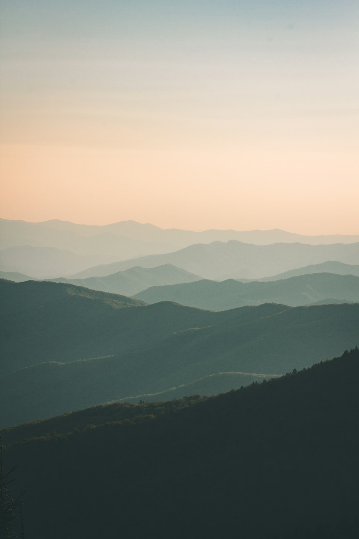
Geological Wondering in White Pocket
White Pocket stands out for geological-wondering in northern Arizona's Vermilion Cliffs National Monument due to its chaotic, twisted Navajo sandstone formations from collapsed Jurassic dunes 160-190 million years old. Unlike the orderly waves nearby, these soft, white rocks deformed through water saturation, freeze-thaw erosion, and mineral deposits create brain-like convolutions, vibrant swirls in red, orange, yellow, and purple, and natural water pockets in an otherwise barren desert.[1][2][5]
Top pursuits include wandering unmarked paths among brain rocks, teepees, hoodoos, and swirling patterns, with petrified wood and natural arches adding diversity. Free exploration rewards patient hikers with surreal close-ups of erosion-sculpted textures. Photographers capture dawn light on the white-dominated chaos, revealing iron oxide colors absent in smoother sandstone sites.[3][4][5]
Spring (March-May) and fall (September-November) offer ideal 50-80°F days with low crowds; avoid monsoon summers for flash floods in pockets. Expect deep sand drives, no infrastructure, and fragile rocks demanding careful steps. Prepare with 4WD skills, ample water, and weather checks via BLM resources.[1][2][6]
Early ranchers relied on the water pockets for livestock, embedding White Pocket in Southwest settler history amid Navajo Nation lands. Local guides from Kanab share erosion stories and wildlife insights, like bighorn sheep at oases. This untouched site preserves raw geology without commercialization, fostering quiet reverence for ancient forces.[1][3]
How to Do It Right
Mastering White Pocket's Rock Labyrinth
Plan visits outside peak summer heat from June to August to avoid flash flood risks and extreme temperatures over 100°F. Book guided 4WD tours from Kanab, Utah, if lacking off-road experience, as no permit is needed unlike The Wave. Allow a full day for the 2-hour drive each way from Page and free exploration on foot.[2][3]
Pack for remote desert conditions with no facilities, water sources, or cell service. Wear sturdy boots for uneven, fragile rock terrain and layers for temperature swings from 30°F nights to 80°F days. Carry a detailed GPS map or offline app, as trails are unmarked and navigation demands precision.[1][4]