Researching destinations and crafting your page…
4.7Overall Rating
3 monthsPeak Season
$40/dayBudget From
5Curated Articles
Top Highlights for Summit Hiking in Arctic Circle Trail
Summit Hiking in Arctic Circle Trail
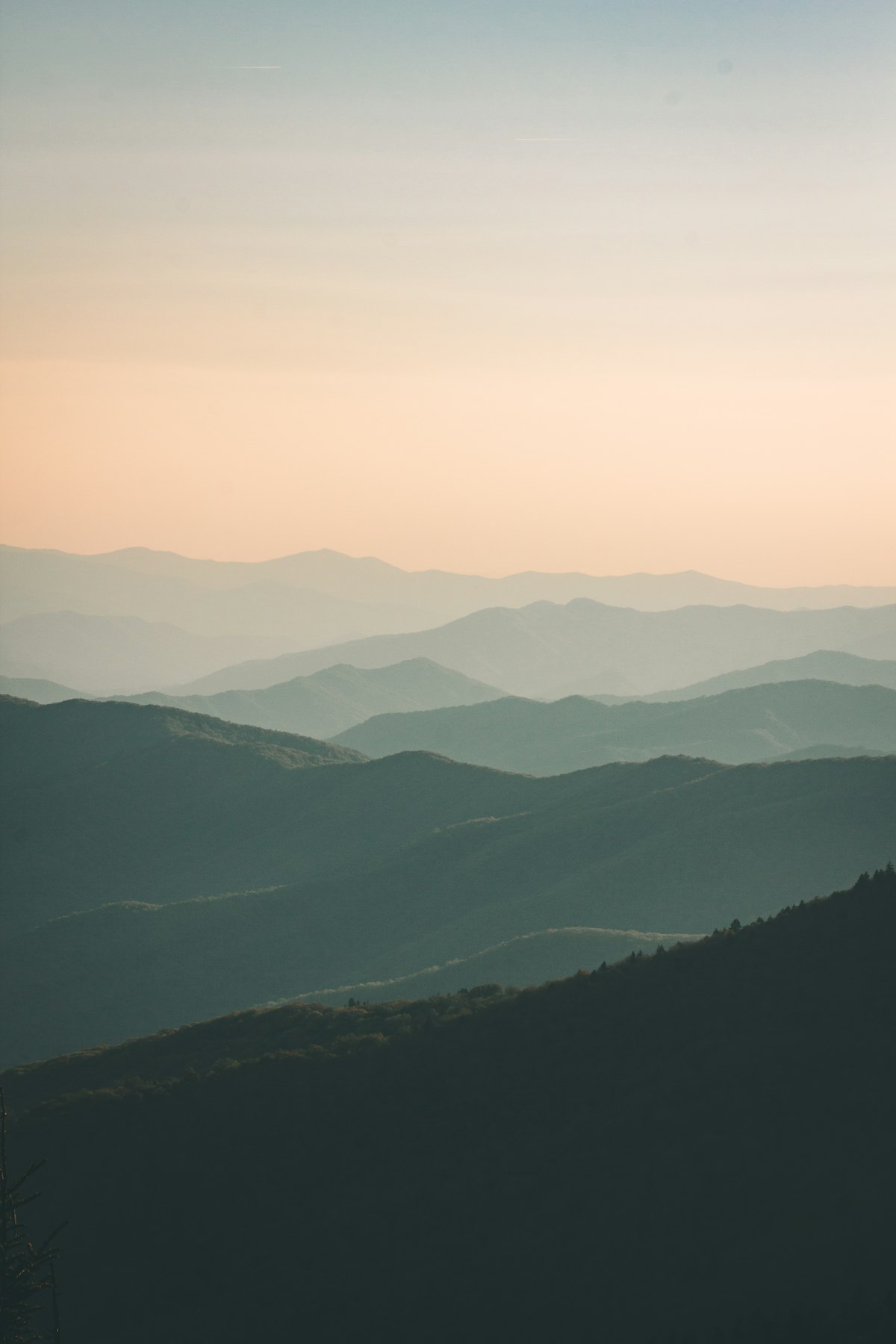
The Arctic Circle Trail is one of the world’s most authentic “summit‑hiking” corridors precisely because it lacks marked alpine peaks yet bristles with inviting ridges and unnamed hilltops begging to be climbed. Stretching roughly 165 km between Kangerlussuaq and Sisimiut, this is a raw, road‑less route through the Arctic tundra, where the real reward is the feeling of walking along the edge of the Greenland Ice Sheet and then down toward the coast. Repeated ascents of low‑elevation ridges add a subtle summit‑hiking rhythm to the journey, turning a long‑distance trek into a series of daily vantage‑point discoveries.
Summit‑hiking on the Arctic Circle Trail unfolds between gentle rolling hills and more pronounced rocky spines, particularly near locations such as Eqalugaarniarfik, Innajuattoq, Nerumaq, and the high ground above Kangerluarsuk Tulleq. These ridges rarely exceed a few hundred meters above sea level, but they deliver expansive views across the “land of a hundred lakes,” jagged glacial valleys, and distant ice‑caps. Adding a short ice‑cap extension from Point 660 also offers a surreal, almost lunar “summit” onto the Greenland Ice Sheet, where the horizon is simply endless white.
The best time for summit‑hiking on the Arctic Circle Trail is June–August, when temperatures hover between the low‑teens Celsius and just above freezing, and the sun skims the horizon all night. Trails are generally well‑marked with red‑painted cairns and occasional painted reindeer antlers, but weather can turn quickly, so hikers must be prepared for wind, fog, and even sleet at higher points. Most trekking itineraries last 7–10 days, allowing enough time to lung‑cleansing ridge‑walks without pushing into overly ambitious 20‑km‑plus summit‑days every single day.
Local Greenlandic culture meets adventurers primarily at the trail’s start and finish in Kangerlussuaq and Sisimiut, where you can pick up ice‑cap tales, boat operators, and local wisdom about safe mountain practice. While the route itself is solitary, huts and campsites along the way give space for quiet reflection on the resilience of Arctic communities that have walked and hunted these same landscapes for generations. Even in a small guided‑group trek, you carry your own gear and food, reinforcing a sense of self‑reliance that aligns closely with the traditional ethos of summit‑hiking in the Arctic wilderness.
How to Do It Right
Summit‑Hiking in the Arctic Circle Trail
Plan your summit‑hikes for the core summer months of June–August when lakes are mostly ice‑free, daylight is near‑continuous, and temperatures in the low‑teens Celsius make exposed ridges more comfortable. Book flights into Kangerlussuaq well ahead, especially if you also want to tack on the Icecap extension from Point 660, since logistics are limited and some guided‑group options are being reduced from 2027. Decide early whether you will junction‑summit‑hike from the main Arctic Circle Trail or add a dedicated side‑ridge day, so you can pack weight and time appropriately.
Expect strong, unbroken winds and rapidly shifting weather even in midsummer, so pack layers that can handle near‑freezing temperatures and a sudden downpour. Bring a tough, lightweight tent, a shelter‑breaking windproof shell, extra batteries, and a GPS or offline map app, as summit ridges can quickly blur into white‑out or fog when low cloud moves in. Always carry a satellite communicator such as an InReach device, and consider joining a guided‑group trek if you want on‑trail safety and route‑finding support in this remote, unroaded landscape.