Researching destinations and crafting your page…
4.8Overall Rating
4 monthsPeak Season
$25/dayBudget From
5Curated Articles
Top Highlights for Hiking Viewpoints in Annapurna Circuit
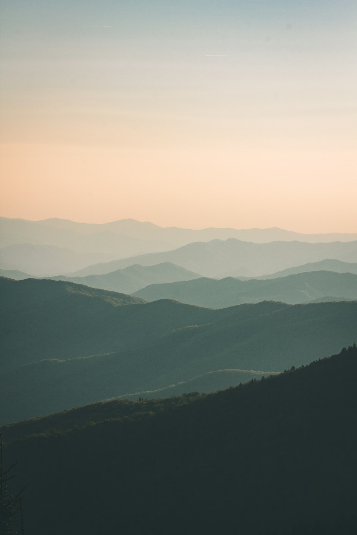
Hiking Viewpoints in Annapurna Circuit
The Annapurna Circuit stands out for hiking-viewpoints due to its 200-kilometer arc encircling the Annapurna massif, ascending from subtropical valleys to 5,416-meter passes. Trekkers access layered panoramas impossible elsewhere, from mid-altitude Annapurna II vistas to barren high-Himalayan expanses. Unique diversity spans river gorges, glacial lakes, and rhododendron ridges, all framed by 8,000-meter giants.
Prime experiences include the Thorong La Pass summit for 360-degree range views, Upper Pisang's mid-circuit panoramas of multiple peaks, and Chongkor above Manang for valley-spanning acclimatization hikes. Side trips to Gangapurna Lake and Tilicho Lake add turquoise glacial reflections beneath sheer faces. Trails weave through Ngawal and Ghyaru for close-up Annapurna IV shots amid ancient villages.
Trek March-May or October-November for stable weather and peak visibility; monsoons bring landslides, winter snow blocks passes. Expect cold nights above 3,000 meters, dusty winds in Kali Gandaki, and rapid altitude gains requiring acclimatization. Prepare with fitness training, permits, and insurance covering helicopter evacuation.
Gurung, Thakali, and Manangi communities line the circuit, sharing teahouses with momos and apple brandy while guarding sacred gompas near viewpoints. Locals point out auspicious peaks during prayer flag ceremonies, blending spiritual hikes with homestay immersion. This cultural thread turns viewpoints into communal sunrise gatherings.
How to Do It Right
Mastering Circuit Viewpoint Summits
Plan 12-18 days for the full Annapurna Circuit to include key viewpoints, obtaining a TIMS permit and Annapurna Conservation Area Permit in Kathmandu or Pokhara. Book guides or porters via licensed agencies for safety on high passes; independent treks suit experienced hikers. Start from Besisahar in peak months to avoid monsoon closures and ensure acclimatization days at Manang.
Acclimatize properly with rest days to prevent altitude sickness on viewpoints above 3,500 meters. Pack layers for -10°C nights at Thorong High Camp and download offline maps like Maps.me. Hire local guides in villages for hidden ridge paths and cultural insights that enhance viewpoint experiences.